Missions Through Geography Unit Study
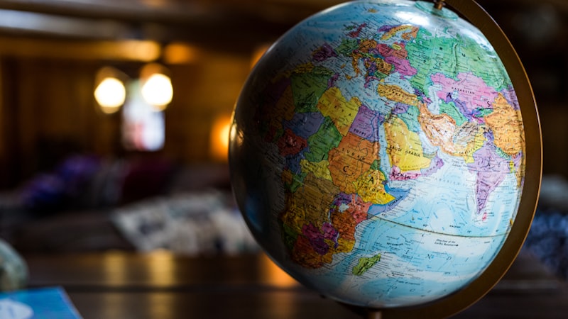
The map was spread across the dining room table, its corners held down by a coffee mug, a jar of peanut butter, a Bible, and a salt shaker. Twelve-year-old Isaac knelt on his chair and leaned over the Karakoram Highway, a thin red line snaking through the mountains of northern Pakistan, with a yellow highlighter in his hand. He traced the road from Islamabad to the Chinese border, the highlighter squeaking against the glossy paper. His younger sister, seven-year-old Abigail, was counting countries in Central Asia with her finger. “Kur-giz-stan,” she said slowly, pressing her fingertip into the pale green shape. “Taj-ik-istan. Uz-bek-istan.”
Their mother sat at the end of the table, reading aloud from a profile of the Baloch people, nomadic herders who migrate across the deserts of Pakistan and Iran with their flocks, sleeping in low black tents made from woven goat hair, drinking salt tea from small brass cups, and navigating by stars that blaze in a sky unblocked by city light.
“The Baloch people number over ten million,” she read. “Fewer than one percent are Christians. There is no complete Bible in the Balochi language.”
Isaac looked up from the map. “Where are they?”
His mother pointed. Balochistan. The largest and least populated province in Pakistan. Isaac highlighted it in orange.
That morning, he had covered geography, history, language, religion, and prayer, all from one map and one people group profile. The dining room table was a classroom. The coffee mug was holding down the Himalayas.
Geography is the skeleton of missions education. Without it, unreached people groups float in abstraction, names without places, people without terrain. With it, children can see why the Baloch are isolated (desert), why the Tibetans are hard to reach (mountains), why the Malay fishing villages are scattered (islands), and why the gospel has moved slowly through the 10/40 Window, the band of the world between 10 and 40 degrees north latitude where physical geography and political barriers conspire to keep entire nations without access to the good news.
This unit study connects geography to missions in a way that works for homeschool families, co-ops, Sunday school classes, and any setting where a map and a willing teacher meet. If your family is building a broader homeschool missions curriculum, this geography unit is designed to plug into any weekly schedule.
Unit Structure: Five Regions, Five Weeks
Each week focuses on one world region, one or two unreached people groups within that region, and the physical geography that shapes their lives. The geography is not background decoration, it is the reason these people eat what they eat, build what they build, and remain unreached.
| Week | Region | People Group(s) | Geographic Focus |
|---|---|---|---|
| 1 | South Asia | Yadav of India, Baloch of Pakistan | River plains, deserts, monsoons |
| 2 | Central Asia | Uzbek, Kazakh | Steppe, mountains, Silk Road |
| 3 | Middle East / North Africa | Persian of Iran, Berber of Morocco | Deserts, mountain ranges, oil economies |
| 4 | Sub-Saharan Africa | Fulani of Nigeria, Somali of East Africa | Sahel, savanna, pastoralism |
| 5 | Southeast Asia | Malay of Malaysia, Thai of Thailand | Islands, coasts, monsoon forests |
Week 1: South Asia. Rivers, Plains, and Monsoons
Map Activity
Print a blank map of South Asia (India, Pakistan, Bangladesh, Nepal, Sri Lanka). Label the following by hand:
- Rivers: Ganges, Indus, Brahmaputra
- Mountains: Himalayas, Karakoram, Hindu Kush
- Deserts: Thar Desert, Balochistan Desert
- Cities: Delhi, Islamabad, Dhaka, Kathmandu
Color the Gangetic Plain green. Color the deserts tan. Color the mountain ranges brown. The act of coloring a map imprints geography into muscle memory, a child who has colored the Ganges blue will recognize it on any map for the rest of her life.
People Group Study: The Yadav of India
The Yadav are a community of over 60 million people who live primarily in the states of Uttar Pradesh and Bihar, the flat, fertile Gangetic Plain where the soil is black and the monsoon rains arrive in July like a wall of water and turn the fields into mirrors. Yadav families have traditionally herded cattle and water buffalo. In the early morning, before the heat rises off the plain like steam from a pot, Yadav farmers milk their buffalo in open-air sheds, the warm milk frothing into tin pails.
Geography connection: The Gangetic Plain is one of the most densely populated regions on earth. Over 500 million people live along the Ganges and its tributaries. The density means that a single unreached people group, like the Yadav, can number in the tens of millions and still remain invisible to the global church.
Discussion: Why does population density make missions harder, not easier? (More people does not mean more access. It means more complexity, more languages, more social barriers, more competition for attention.)
People Group Study: The Baloch of Pakistan
Shift from the green plains to the brown desert. The Baloch inhabit one of the harshest landscapes on the planet, rocky plateaus, sand dunes, and dry riverbeds that fill only during flash floods. Water is the organizing principle of all life. Settlements cluster around wells. Migration follows the seasons. The heat in summer reaches 120 degrees Fahrenheit. The silence of the desert at night is broken only by wind and the occasional cry of a jackal.
Geography connection: Geographic isolation is one of the primary reasons people groups remain unreached. The Baloch are not hiding. They are simply far from everywhere else. The terrain itself is a barrier, and understanding that barrier is the beginning of understanding missions.
Cross-Curricular Extensions
- Math: Calculate the distance from your home to the Thar Desert. If you drove 60 miles per hour without stopping, how long would it take?
- Science: Research the monsoon cycle. What causes monsoons? How do they affect agriculture in the Gangetic Plain?
- Language arts: Write a journal entry from the perspective of a Yadav child waking up to milk buffalo at dawn. What does she see, hear, smell?
- Prayer: Pray for the Yadav and the Baloch by name. Pray for the geographic barriers to be overcome, not by bulldozers but by people willing to walk into hard places.
Week 2: Central Asia. Steppe, Silk Road, and the Gospel Underground
Map Activity
Print a blank map of Central Asia (Kazakhstan, Uzbekistan, Turkmenistan, Tajikistan, Kyrgyzstan). Label:
- Mountains: Tian Shan, Pamir, Hindu Kush
- Deserts: Karakum, Kyzylkum
- Rivers: Amu Darya, Syr Darya
- Cities: Tashkent, Samarkand, Almaty, Bukhara, Ashgabat
- Historic route: Draw the Silk Road from China through Samarkand to the Mediterranean
Color the steppe yellow-green. Color the deserts pale brown. Mark the Silk Road in red.
People Group Study: The Uzbek
Samarkand’s Registan Square has stood for over six hundred years, three madrasas facing each other across a vast courtyard, their facades covered in turquoise and cobalt tilework that glitters in the Central Asian sun. The tiles are geometric, mathematical, detailed. They represent a civilization that valued learning, art, and order.
The Uzbek people today are overwhelmingly Sunni Muslim. The few Uzbek Christians face social pressure, government surveillance, and isolation. Gathering for worship requires discretion. Owning Christian literature can invite questions from neighbors. The gospel is present in Uzbekistan, but it moves quietly, like water through cracks in stone.
Geography connection: Central Asia is landlocked. No ocean port. No easy access. The Silk Road once connected it to the world, but when sea routes replaced overland trade, Central Asia became isolated, politically, economically, and spiritually. Understanding landlocked geography helps children understand why some regions are harder to reach than others.
Cross-Curricular Extensions
- History: Research the Silk Road. What goods traveled along it? (Silk, spices, horses, ideas, and religions. Christianity reached Central Asia via the Silk Road in the 7th century through Nestorian missionaries.)
- Art: Create Uzbek-style geometric tile patterns on graph paper. Use only compass and straightedge. The mathematical precision teaches geometry.
- Cooking: Make Uzbek plov (see our recipes from unreached nations for the full recipe). The smell of cumin and caramelized carrots fills the room.
- Prayer: Pray for the underground church in Central Asia. Pray for courage.
Week 3: Middle East and North Africa. Deserts, Mountains, and Ancient Faith
Map Activity
Print a blank map of the Middle East and North Africa. Label:
- Deserts: Sahara, Arabian Desert, Dasht-e Kavir (Iran)
- Mountains: Atlas (Morocco), Zagros (Iran), Elburz (Iran)
- Rivers: Nile, Tigris, Euphrates
- Cities: Tehran, Marrakech, Cairo, Baghdad, Istanbul
- Bodies of water: Persian Gulf, Red Sea, Mediterranean
People Group Studies
The Persian people of Iran, heirs to a civilization that stretches back to Cyrus the Great. Modern Iran is a nation of contrasts: ancient ruins and nuclear facilities, strict religious law and a thriving underground art scene. The house church movement in Iran has grown rapidly, but believers live under constant risk.
The Berber people of Morocco, the Imazighen, who have lived in North Africa since before the Romans arrived. Their villages cling to the Atlas Mountains, built from reddish clay that blends into the hillside. Women weave carpets in patterns that encode clan identity and spiritual meaning.
Geography connection: The Sahara Desert separates North Africa from sub-Saharan Africa more effectively than any political border. Mountains isolate villages from each other and from the lowland cities where the church is stronger. Physical geography creates pockets of unreachedness, places where the gospel simply has not arrived because the terrain makes arrival hard.
Week 4: Sub-Saharan Africa. Sahel, Savanna, and Pastoralism
Map Activity
Label the Sahel, the semi-arid belt stretching from Senegal to Sudan, south of the Sahara. This is one of the most concentrated zones of unreached people groups on earth.
People Group Studies
The Fulani, over 40 million people spread across West Africa, many of them semi-nomadic herders who move with their cattle along seasonal routes, following the rains across the Sahel. The dust kicks up around the hooves of their long-horned Zebu cattle. They carry their possessions on donkeys. They sleep under thorn-branch shelters.
The Somali, pastoralists and traders in the Horn of Africa. The landscape is dry scrubland and red dust. Camels are wealth. Poetry is currency.
Geography connection: Pastoralism and nomadic life make traditional church planting difficult. A stationary church building serves a stationary population. The Fulani are not stationary. The gospel must move with them, on foot, through oral storytelling, in their heart language.
Week 5: Southeast Asia. Islands, Coasts, and Monsoon Forests
Map Activity
Print a map of Southeast Asia. Label the major island chains: Indonesia (over 17,000 islands), the Philippines, Malaysia. Count the islands visible on the map. You will lose count. That is the point.
People Group Studies
The Malay people, primarily in Malaysia and Indonesia, living in fishing villages where wooden houses stand on stilts above the water and brightly painted boats rest on the sand. The smell of drying fish and salt air.
Geography connection: Island geography fragments people groups. Indonesia alone has over 700 languages. Each island, each valley, each coast can hold a distinct people group with its own language and its own need for the gospel. Bible translation in island nations is not one project, it is hundreds.
The Map as Theology
A map is not neutral. It is a confession.
When a child looks at a world map and sees the 10/40 Window, that belt of nations stretching from West Africa through the Middle East and into East Asia, she is looking at the front line of God’s great rescue plan. The geography tells a story: mountains isolate, deserts separate, islands fragment, and the gospel must cross every one of those barriers to reach every people group God has placed on earth.
In Acts 17:26-27, Paul tells the Athenians:
“And he made from one man every nation of mankind to live on all the face of the earth, having determined allotted periods and the boundaries of their dwelling place, that they should seek God, and perhaps feel their way toward him and find him. Yet he is actually not far from each one of us” (ESV)
God placed the Baloch in the desert. He placed the Fulani on the Sahel. He placed the Malay on the islands. Not to hide them but so that the search for him would take the church to every corner of his creation.
Geography is not an obstacle to God’s plan. It is the terrain of God’s plan. And when a child traces a river on a map and learns that a people group lives along its banks without the gospel, she is seeing, for the first time, with a highlighter in her hand, the scope of what God is doing in the world.
The map is waiting. The highlighter is ready. And God, who placed every mountain and carved every river, is not finished filling the earth with his glory.
Brought to you by Wonder Letters
Monthly missions letters for families. 50% of profits support Global Serve International.